MIDDLE DESCHUTES RIVER
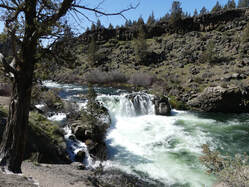
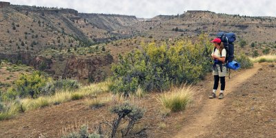
The middle Deschutes River is a ribbon of blue and green through an arid landscape with canyon walls on which you can spot golden eagle nests and hear the melodic song of canyon wrens. Hikers walk along Steelhead Falls Trail on hot days, seeking cool, cascading water at the falls.
The middle Deschutes River is a ribbon of blue and green through an arid landscape with canyon walls on which you can spot golden eagle nests and hear the melodic song of canyon wrens. Hikers walk along Steelhead Falls Trail on hot days, seeking cool, cascading water at the falls.
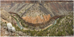
Photo: Greg Burke
LOWER CROOKED RIVER
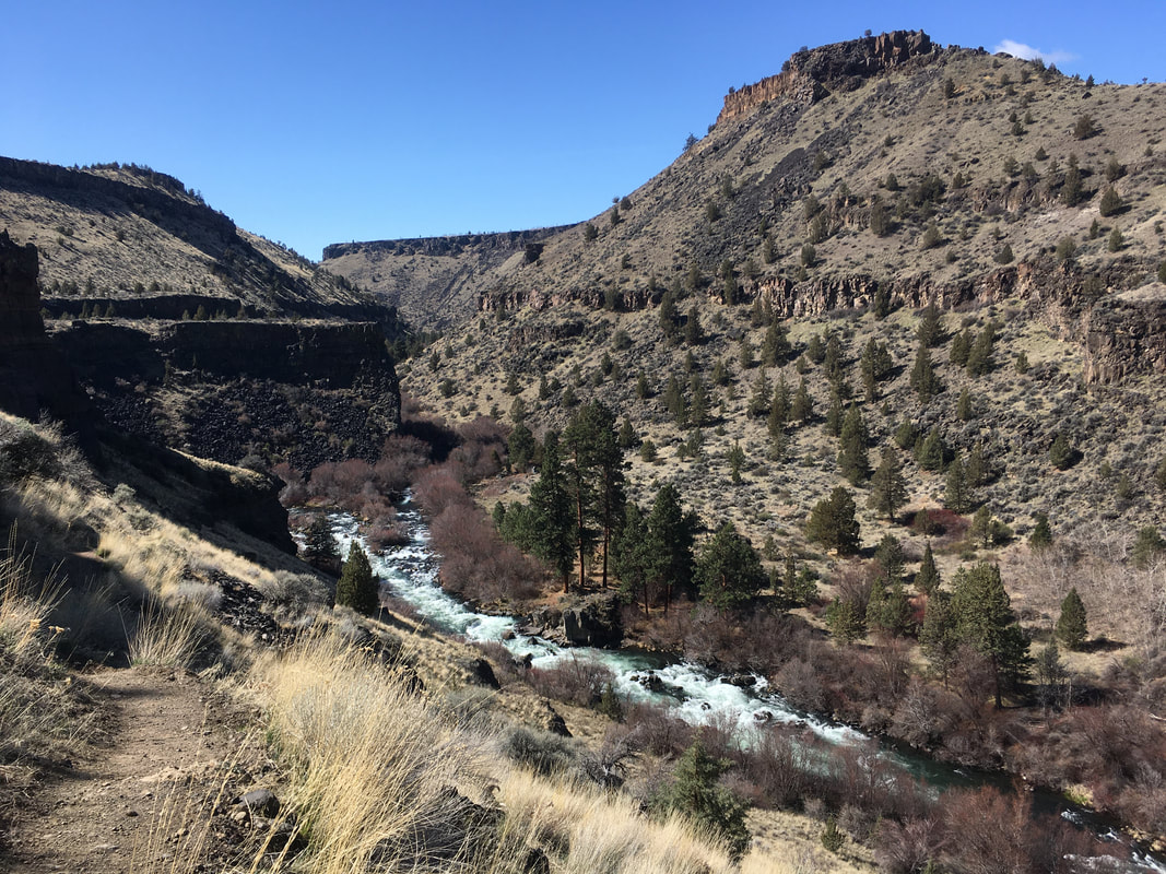
The lower Crooked River Canyon provides expansive views of the surrounding landscape. The dry canyon ledges contrast sharply with the cool running river below. The river is accessible on hiking trails including Lone Pine Trail.
The lower Crooked River Canyon provides expansive views of the surrounding landscape. The dry canyon ledges contrast sharply with the cool running river below. The river is accessible on hiking trails including Lone Pine Trail.
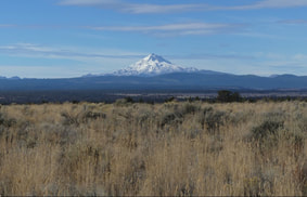
THE PENINSULA
Bordered by the middle Deschutes River to the west and the lower Crooked River to the east, the Peninsula offers sweeping views of the Cascade Mountains and both river canyons. Hikers, horseback riders, bicyclists, and birders use Peninsula road (a county road) and connecting USFS roads to explore the Peninsula and its amazing native plant life and bird species. In the summer, you can hear meadowlarks singing their melodious songs from the top of juniper trees.
Bordered by the middle Deschutes River to the west and the lower Crooked River to the east, the Peninsula offers sweeping views of the Cascade Mountains and both river canyons. Hikers, horseback riders, bicyclists, and birders use Peninsula road (a county road) and connecting USFS roads to explore the Peninsula and its amazing native plant life and bird species. In the summer, you can hear meadowlarks singing their melodious songs from the top of juniper trees.
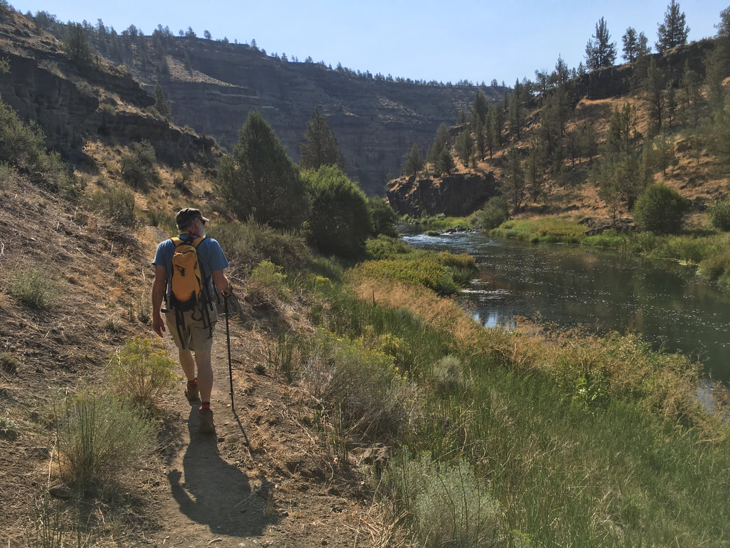
Lower Whychus Creek
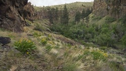
Photo: Greg Burke
Starting in Three Sisters Wilderness, Whychus Creek meets the Deschutes River in Deschutes-Steelhead Falls Wilderness Study Area. Whychus Creek, meaning "the place we cross the water," has a long history of use by Native Americans. Alder Springs Trail leads to the confluence of Whychus Creek and the middle Deschutes River.
LOCAL TRAILS
|
Alder Springs Trail: Located on lower Whychus Creek, Alder Springs is an oasis in the high desert. Hiking down to the springs you will be treated with panoramic views of the Cascades, towering rock formations and expansive vistas of Whychus Creek Canyon. Click here for driving directions to Alder Springs Trail.
Steelhead Falls Trail: This spectacular waterfall is the most well-known and popular destination in the middle Deschutes area. A short 1/4 mile hike along the Deschutes River takes you to the cliffs overlooking the roaring falls. Click here for driving directions to Steelhead Falls Trail. Click here for a Steelhead Falls Trail native plant checklist. Scout Camp Trail: This short loop trail on the middle Deschutes is one of the most visually stunning hikes you'll find in the Central Oregon. Hiking down into the Deschutes Canyon gives a firsthand view of the tumultuous geological history of our region and the dramatic middle Deschutes Canyon. A short scramble over some boulders at the river allows you to complete the loop trail and enjoy views of the confluence of Whychus Creek and the Deschutes, or you can return the way you came. Click here for directions to the trailhead. Otter Bench Trail: Located on the lower Crooked River, the Otter Bench trail System has something for everyone. The 3.5 mile loop takes you along the canyon rim, and two shorter trails take you on a more strenuous hike into the spectacular sheer-walled canyon of the Crooked River. Those looking for a longer excursion on horseback or mountain bike can connect to the 5 mile Opal Canyon trail from the Otter Bench trail. Parking for the Otter Bench Trail is at the end of Horny Hollow road. Click here for directions to the trailhead. |
Alder Springs Trail at Whychus Creek | Greg Burke
Steelhead Falls Trail | Sue Combs
Scout Camp Trail | Sue Combs
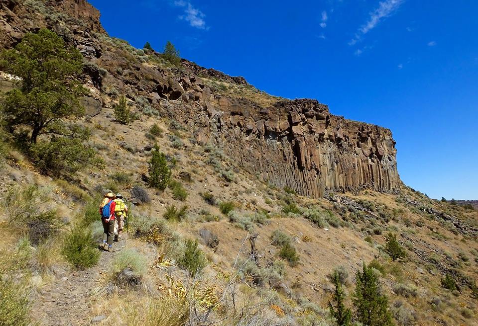
Otter Bench Trail near Lower Crooked River | Joan Amero
|
