Friends and Neighbors of Deschutes Canyon Area
Follow us on Facebook:
  • Home
  • Our Work
    • Education >
      • Native Plants & Weeds
      • Native Plant Interpretive Garden
      • Crooked River National Grassland Nest Box Trail
    • Stewardship >
      • Monarch Waystations
      • Golden Eagle Nest Surveys
      • Wildlands Monitoring Project
    • Deschutes-Steelhead Falls Wilderness Study Area
    • National Conservation Lands
  • Events
    • Lens on Learning Series
    • Guided Hikes
    • Stewardship Projects
  • Get Involved
    • Board Members & Coordinators
    • Membership & Donation
    • Volunteer
    • Contact Us
  • Explore Deschutes Canyon Area
  • Related Links

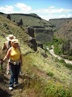
Scout Camp Trail on the Middle Deschutes - Directions to the Trailhead

Picture

Driving north on Hwy 97, just north of Terrebonne, turn left on to Lower Bridge Road(Sign with left arrow says “Crooked River Ranch”).
After 2 miles turn right on 43rd St.
After 1.7 miles turn left on Chinook Dr.
After 2.3 miles turn left on Mustang.
Travel 1.1 mile and turn right on Shad Rd.
Travel 1.4 mile and turn right on Peninsula Drive.
Travel 3.2 miles and turn left on Meadow Rd.
Travel ½ mile and turn right on Scout Camp Trail. Go .2 mile and park at the end.


Powered by Create your own unique website with customizable templates.